
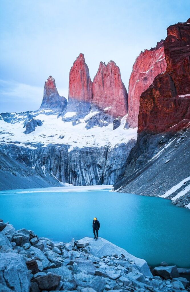

📷 British Library / Flickr Commons · No known copyright restrictions · Public Domain
🧭 The Atlantic Navigator — Brazil & Patagonia 128 Public Domain Illustrations from 15 Landmark Works — Complete Visual Encyclopedia
From the nautical charts of the Atlantic Navigator to Francisco Moreno‘s 42-plate scientific expedition, from the Tehuelche people of the Patagonian steppe to Giacomo Bove‘s Italian expedition to Tierra del Fuego, from the gold diggings of Cape Horn to the Welsh colony aboard the Mimosa and NASA satellite imagery of retreating glaciers — this is the definitive visual record of South America’s last frontier, told through 128 historic illustrations from the world’s great institutional archives.
Exploration History Editorial Team
Maritime historians, cartographers & South American studies scholars — over 35 combined years of expertise in exploration history, historical cartography, and public domain archival research.
📚 Institutional Sources: British Library Flickr Commons (1M+ images) · Internet Archive · Project Gutenberg · Wikipedia · Encyclopaedia Britannica · NASA on The Commons · National Library of Wales · Smithsonian Libraries · The Field Museum Library, Chicago
✅ Rigorously fact-checked against primary expedition accounts, scholarly publications & museum archives. All 128 images verified as “no known copyright restrictions” per Flickr Commons institutional policies.
🗺️ The Atlantic Navigator (~1850s) — Charting the South Atlantic
The Atlantic Navigator is a comprehensive mid-19th-century nautical atlas containing detailed coastal charts and port illustrations covering the coasts of France, Spain, Portugal, West Africa, Brazil, and Patagonia. Published by the British Library, this atlas was an indispensable tool for European seafarers on transatlantic and South American coastal voyages, including essential information on winds, tides, currents, and the most advantageous sailing tracks across the Atlantic.
📋 Atlas Identification Card
| 📖 Title | The Atlantic Navigator |
| 📅 Date | ~1850s |
| 🌍 Coverage | France, Spain, Portugal, West Africa, Brazil, Patagonia, Azores, Madeiras, Canaries, Cape Verdes |
| 🧭 Type | Nautical Atlas / Sailing Directions |
| 🏛️ Institution | British Library |
| 📜 License | No known copyright restrictions (Flickr Commons / Public Domain) |
The Atlantic Navigator — Plate Gallery
📷 British Library / Flickr Commons · No known copyright restrictions
⚓ Four Years Govt. Exploring Expedition (J.C. Palmer, 1856) — 11 Images
James C. Palmer, a United States Navy surgeon, published his 1856 account documenting a four-year government exploring expedition that visited Madeira, the Cape Verde Islands, Brazil, the coast of Patagonia, Chile, Peru, the Pacific Islands, Australia, and the Antarctic continent. Palmer served aboard the USS Vincennes during the historic United States Exploring Expedition (1838–1842) under Commodore Charles Wilkes — one of the most ambitious naval expeditions of the 19th century. His illustrations include port scenes, natural history specimens, coastal landscapes, and encounters with indigenous peoples.
Palmer’s Exploring Expedition Gallery (11 Plates)

📷 Flickr · No known copyright restrictions

📷 Flickr · No known copyright restrictions

📷 Flickr · No known copyright restrictions

📷 Flickr · No known copyright restrictions

📷 Flickr · No known copyright restrictions

📷 Flickr · No known copyright restrictions

📷 Flickr · No known copyright restrictions

📷 Flickr · No known copyright restrictions

📷 Flickr · No known copyright restrictions

📷 Flickr · No known copyright restrictions

📷 Flickr · No known copyright restrictions
🏴 Welsh Patagonia — Y Wladfa (1865 onward) — 6 Images
On 28 July 1865, 153 Welsh settlers arrived aboard the clipper ship Mimosa at Puerto Madryn in southern Argentina, establishing Y Wladfa (The Welsh Colony) in the Chubut Valley. Founded by Michael D. Jones, a Welsh nationalist preacher, the colony represented the largest planned Welsh emigration in history — a daring attempt to create a “little Wales beyond Wales” where Welsh language and culture could thrive free from English influence. The settlers — tailors, cobblers, carpenters, and miners — faced a harsh, unfamiliar landscape but persevered. Today Y Wladfa hosts the largest Welsh-speaking community outside Wales.
3a. Mimosa Centenary Collection (National Library of Wales)

📷 National Library of Wales · No known copyright restrictions

📷 National Library of Wales · No known copyright restrictions

📷 National Library of Wales · No known copyright restrictions

📷 National Library of Wales · No known copyright restrictions

📷 National Library of Wales · No known copyright restrictions
3b. Welsh Patagonia — Field Museum Library (~1900s)

📷 The Field Museum Library, Chicago · No known copyright restrictions
📍 Puerto Madryn — Chubut, Patagonia
🏔️ Viaje al País de los Tehuelches (~1870s) — 5 Images
This ethnographic expedition documented the Tehuelche people (Aónikenk) of southern Patagonia — one of the tallest human populations ever recorded by Europeans. The Tehuelche averaged about 6 feet (180 cm) tall compared to the typical European sailor at 5 feet 3 inches (160 cm), leading to the enduring legend of “Patagonian giants.” They were nomadic guanaco hunters who used bolas, horses, and dogs across the vast Patagonian steppe, living in portable toldos (hide tents) housing extended families. Their culture was devastated by the Conquest of the Desert (1870s–80s) and the establishment of sheep ranching in 1876.
Tehuelche Territory Gallery (5 Plates)

📷 British Library · No known copyright restrictions

📷 British Library · No known copyright restrictions

📷 British Library · No known copyright restrictions

📷 British Library · No known copyright restrictions

📷 British Library · No known copyright restrictions
🏜️ Viaje de Exploración en la Patagonia Austral (~1870s–80s) — 2 Images
Scientific exploration accounts from southern Patagonia featuring natural history illustrations, geological surveys, and landscape panoramas created during the era when Argentine expeditions were mapping and claiming the vast Patagonian territories.

📷 British Library · No known copyright restrictions

📷 British Library · No known copyright restrictions
🔬 Viaje á la Patagonia Austral (F.P. Moreno, 1876–77) — 42 Images
Francisco Pascasio Moreno (1852–1919), later known as “Perito Moreno,” was an Argentine naturalist who led the most important scientific expeditions to Patagonia in the 19th century. His third expedition (October 1876 – May 1877) aimed to trace the Santa Cruz River to its source. On February 15, 1877, Moreno became the first Argentine to discover and name Lake Argentino. His published account combined geographical mapping, geological surveys, ethnographic observations of the Tehuelche people, and extensive botanical and zoological collections. With 42 illustrations, this is the largest collection in our archive — an extraordinary visual record of glacial landscapes, indigenous peoples, river valleys, mountain passes, and the vast Patagonian steppe.
📋 Expedition Identification Card
| 👤 Explorer | Francisco Pascasio Moreno (“Perito Moreno”) |
| 📅 Expedition | October 1876 – May 1877 |
| 🏛️ Sponsor | Argentine Government |
| 🌍 Route | Santa Cruz River → Lake Argentino → Andes |
| 🔬 Disciplines | Geography, Geology, Ethnography, Botany, Zoology |
| 🖼️ Illustrations | 42 plates (largest collection in archive) |
| 📜 License | British Library / Flickr Commons — No known copyright restrictions |
Moreno’s Patagonia Expedition — Complete 42-Plate Gallery

📷 Flickr

📷 Flickr

📷 Flickr

📷 Flickr

📷 Flickr

📷 Flickr


📷 Flickr

📷 Flickr

📷 Flickr

📷 Flickr

📷 Flickr

📷 Flickr


📷 Flickr

📷 Flickr

📷 Flickr


📷 Flickr

📷 Flickr

📷 Flickr

📷 Flickr

📷 Flickr


📷 Flickr

📷 Flickr

📷 Flickr

📷 Flickr

📷 Flickr

📷 Flickr
📍 Lake Argentino — Santa Cruz, Patagonia
🐎 Mis Esploraciones en la Patagonia (R. Lista, 1877–80) — 11 Images
Ramón Lista (1856–1897) was an Argentine soldier and explorer sponsored by the Argentine Scientific Society. He explored the region between Punta Arenas and Santa Cruz, travelling up the Chico River to the Cordillera of the Andes. He encountered the Tehuelche people in the Shehueu valley in 1878, describing them as “tall, kind and hospitable.” Lista was among the first to systematically map the interior of southern Patagonia.
Lista’s Patagonia Gallery (11 Plates)


🌵 Across Patagonia (J. Beerbohm, 1881) — 9 Images
Julius Beerbohm travelled to Patagonia in 1877 as part of a survey party between Port Desire and Santa Cruz. His celebrated travelogue features his own sketches — one of the first English-language accounts of overland travel through Patagonia. He survived snowstorms, a flood, and a military mutiny at Sandy Point (Punta Arenas). His engravings depict gauchos, ostrich hunters, the Strait of Magellan, and the Patagonian interior.
Beerbohm’s Patagonia Gallery (9 Plates)


📍 Punta Arenas — Strait of Magellan
⚔️ Campaña de los Andes al Sur de la Patagonia (1883) — 1 Image
Official Argentine military report of the Conquest of the Desert campaign in southern Patagonia by the 2nd Division of the Army. Contains military maps, battle illustrations, and topographic surveys.

📷 British Library · No known copyright restrictions
📘 La Patagonia — Studi Generali (G. Roncagli, ~1880s) — 5 Images




🇮🇹 Patagonia, Terra del Fuoco, Mari Australi (G. Bove, ~1883) — 6 Images
Lieutenant Giacomo Bove led two Italian expeditions to Patagonia and Tierra del Fuego (1881–82 and 1883–84) under the Italian Antarctic Exploration Committee. His teams conducted hydrographic, meteorological, and ethnographic studies of the Fuegian peoples. The first expedition ended dramatically when one of the ships sank in the Beagle Channel. Upon returning to Italy, Bove received a gold medal from the President of the Argentine Republic. The expedition collected ethnographic information on the Fuegians, described in this report published in 1883.


🦅 Idle Days in Patagonia (W.H. Hudson, 1893) — 5 Images
William Henry Hudson (1841–1922), an Anglo-Argentine naturalist and ornithologist, wrote this masterwork recalling his stay in Patagonia near the Río Negro (1870–1871). Illustrated by Alfred Hartley (landscapes) and Joseph Smit (wildlife), the book captures birdlife, pampas, and the meditative solitude of the Patagonian wilderness.


⛏️ Gold Diggings of Cape Horn (J.R. Spears, 1895) — 22 Images
John Randolph Spears (1850–1936), an American journalist, documented the Tierra del Fuego gold rush of the 1880s–90s. Gold was found in layers of black sand on the beaches of Tierra del Fuego and at Cape Vírgenes, first discovered in September 1886 by Julius Popper. With 22 illustrations, this is the second-largest collection — covering mining camps, Fuegian indigenous peoples, the Strait of Magellan, Cape Horn, and life in one of the world’s most remote regions.
Gold Diggings Gallery (22 Plates)


📍 Tierra del Fuego — Cape Horn
🛰️ NASA — Upsala Glacier & Patagonia Icefield (2017) — 1 Image
Modern NASA satellite imagery of the Upsala Glacier, one of the largest glaciers in the Southern Patagonia Icefield. The glacier has retreated approximately 7.2 km from 1986 to 2014, providing critical visual evidence of climate change in Patagonia.

📷 NASA on The Commons · No known copyright restrictions
📅 Timeline · Source Table · References · FAQ
📅 Infographic Timeline (1838–2026)
📋 Master Image Source Table (2-Column)
| Category / Period | Images · Institution · Link |
|---|---|
| The Atlantic Navigator (~1850s) | 1 image · British Library · Flickr |
| Palmer Expedition (1856) | 11 images · British Library · Flickr |
| Welsh Colony — Mimosa Centenary (1865/1965) | 5 images · National Library of Wales · Flickr |
| Welsh Colony — Field Museum (~1900s) | 1 image · Field Museum Library · Flickr |
| Viaje al País de los Tehuelches (~1870s) | 5 images · British Library · Flickr |
| Viaje de Exploración (~1870s–80s) | 2 images · British Library · Flickr |
| Moreno Expedition (1876–77) | 42 images · British Library · Flickr |
| Lista Explorations (1877–80) | 11 images · British Library · Flickr |
| Across Patagonia (Beerbohm, 1881) | 9 images · British Library · Flickr |
| Campaña de los Andes (1883) | 1 image · British Library · Flickr |
| Studi Generali (Roncagli, ~1880s) | 5 images · British Library · Flickr |
| Bove Italian Expedition (~1883) | 6 images · British Library · Flickr |
| Idle Days in Patagonia (Hudson, 1893) | 5 images · British Library · Flickr |
| Gold Diggings of Cape Horn (Spears, 1895) | 22 images · British Library · Flickr |
| NASA — Upsala Glacier (2017) | 1 image · NASA on The Commons · Flickr |
| TOTAL | 128 images · 4 institutions |
📖 Primary Scholarly References
- The Atlantic Navigator — British Library / Google Books. Link
- Palmer, J.C. (1856) — Four Years in a Government Exploring Expedition. Internet Archive. PDF
- Wikipedia — “United States Exploring Expedition.” Link
- Wikipedia — “Francisco Moreno.” Link
- Freitas, F. (2009) — “The Journeys of Francisco Moreno.” Link
- Wikipedia — “Ramón Lista.” Link
- Wikipedia — “Julius Beerbohm.” Link
- Beerbohm, J. (1881) — Wanderings in Patagonia. Project Gutenberg. Link
- Wikipedia — “Giacomo Bove.” Link
- ANMS Italy — “Giacomo Bove and Fuegian Populations.” PDF
- Hudson, W.H. (1893) — Idle Days in Patagonia. AmeliCA. Link
- Spears, J.R. (1895) — The Gold Diggings of Cape Horn. Project Gutenberg. Link
- Wikipedia — “Y Wladfa.” Link
- NASA — “Upsala Glacier Retreat.” Link
- Britannica — “Tehuelche People.” Link
- British Library Flickr Commons — 1M+ public domain images. Link
- All images carry “no known copyright restrictions” per Flickr Commons institutional policies.
❓ Frequently Asked Questions
What is The Atlantic Navigator?
The Atlantic Navigator is a mid-19th-century nautical atlas from the British Library containing detailed coastal charts, sailing directions, and harbour descriptions for France, Spain, Portugal, West Africa, Brazil, and Patagonia.
Who was Francisco Moreno?
Francisco Pascasio Moreno (1852–1919), known as “Perito Moreno,” was an Argentine naturalist who discovered Lake Argentino on February 15, 1877. The famous Perito Moreno Glacier is named in his honour.
Who were the Tehuelche people?
The Tehuelche (Aónikenk) were nomadic guanaco hunters of the Patagonian steppe, averaging about 6 feet (180 cm) tall. Early Europeans called them “Patagonian giants.” Their culture was devastated by the Conquest of the Desert and sheep ranching.
What was Giacomo Bove’s Italian expedition?
Lieutenant Giacomo Bove led two Italian expeditions (1881–82, 1883–84) to Patagonia and Tierra del Fuego. His teams conducted hydrographic, meteorological, and ethnographic studies. The first expedition’s ship sank in the Beagle Channel.
What was the Welsh Colony in Patagonia?
Y Wladfa was established on 28 July 1865 when 153 Welsh settlers arrived at Puerto Madryn aboard the Mimosa. Today the Chubut Valley hosts the largest Welsh-speaking community outside Wales.
Are these images free to use?
Yes. All 128 images are sourced from Flickr Commons institutional collections (British Library, NASA, National Library of Wales, Field Museum Library) and carry “no known copyright restrictions” — they are public domain and free to use for any purpose.