🗺️ Into the Green Hell: The Golden Age of Amazon Exploration
An exhaustive 25-chapter historical documentation detailing the perilous 19th and early 20th-century expeditions that mapped the vast, uncharted Amazon Valley.
✏️ Written & Curated by the Atechsur.org Historical Geography Team | Last Updated: April 1, 2026

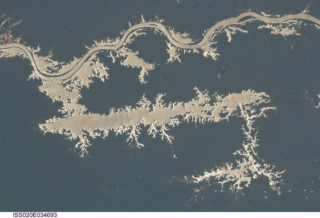
The Amazon Basin remained one of the last great unmapped frontiers on Earth well into the 19th century. To European and American powers, it was a terrifying, disease-ridden “green hell,” yet it held the promise of immense natural wealth—specifically rubber, timber, and exotic biology.
This 25-chapter encyclopedia explores the pivotal mid-19th-century expeditions that finally cracked open the Amazon Valley. We will focus heavily on the monumental 1851-1852 expedition led by US Navy Lieutenants William Lewis Herndon and Lardner Gibbon, viewing their journey through their original, hauntingly beautiful 1853 and 1854 expedition sketches.
- A Divided Journey: Herndon and Gibbon split up to cover more ground. Herndon followed the main trunk of the Amazon, while Gibbon detoured south through Bolivia to explore the Madeira River tributaries.
- The Rubber Boom Catalyst: Their glowing reports of the region’s massive, untapped resources directly contributed to the horrific, exploitative Amazon rubber boom that followed decades later.
- Visual History: Photography was not viable in the humid jungle; the entire expedition was documented via detailed, hand-drawn sketches that were later turned into lithographs.
- Biological Goldmine: Later expeditions, like the Mulford Expedition of 1921, used Herndon’s maps to push deeper, collecting thousands of previously unknown plant and insect species.
Part I: The Descent from the Andes (Chapters 1-5)
 1. The Starting Point: Lima, Peru (1851)

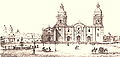
The expedition began in the relatively civilized Spanish colonial capital of Lima, Peru, where Herndon and Gibbon gathered their initial supplies and mules.
In 1851, the US Navy Department tasked Lieutenants William Lewis Herndon and Lardner Gibbon with a monumental mission: cross the South American continent from west to east and assess the Amazon Valley’s potential for American commerce.
They began their journey in Lima, Peru. The contrast between the established, ornate Spanish colonial architecture—captured in this sketch of the Lima Cathedral—and the untamed wilderness they were about to enter could not have been starker. Here, they acquired their initial pack animals and native guides for the brutal ascent into the mountains.
 2. Traversing the High Andes

Before reaching the jungle, the expedition had to cross the freezing, oxygen-deprived peaks of the Andes using local pack animals.
Before they could sail down the Amazon, they had to cross the formidable wall of the Andes Mountains. The physical toll on the men and their animals was immense. They suffered from altitude sickness, freezing temperatures, and treacherous, narrow mountain passes.
Gibbon’s sketches, such as the one showing llamas laden with silver, highlight the economic realities of the high-altitude regions they passed through before descending into the tropical heat of the basin below.
 3. Yanacoto Mountain and the Descent

The rugged terrain documented by Herndon during the descent toward the headwaters.
The descent from the Andean peaks was arguably more dangerous than the ascent. The trails were often nothing more than muddy ledges carved into vertical cliffs. The expedition had to carefully navigate mules loaded with delicate scientific instruments—barometers, chronometers, and sextants—down into the humid valleys.
It was during this descent that the climate changed violently. The dry, freezing air of the mountains was replaced by the suffocating, malaria-ridden humidity of the high jungle (the Montaña).
 4. First Contact: The High Jungle Settlements

A remote outpost marking the transition from Spanish civilization to the deep indigenous territories.
As they reached the upper navigable tributaries of the Amazon, the expedition encountered isolated settlements like Moyoc. These outposts were the ragged edge of Peruvian authority, populated by missionaries, rubber tappers, and indigenous peoples who had been forced into the colonial economic system.
Herndon documented the stark poverty and the incredibly difficult logistics of moving goods upriver against the powerful currents without steam power.
 5. San Mateo and the Headwaters

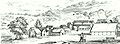
The rugged headwaters where the expedition transitioned from mules to canoes.
At settlements like San Mateo, the true riverine journey began. The expedition abandoned their mules and purchased large dugout canoes (canoas or balsas) from the local indigenous tribes. From this point forward, they were at the mercy of the river’s current, navigating dangerous rapids and avoiding submerged, jagged logs (snags) that could tear the bottom out of their wooden boats.
Part II: Navigating the Unknown (Chapters 6-10)
 6. Ethnographic Encounters

Herndon’s expedition provided some of the first detailed Western sketches of isolated Amazonian tribes.
A major component of Herndon’s mission was ethnographic. The US government wanted to know if the indigenous populations could be utilized as a labor force for future commercial enterprises. Herndon’s sketches documented their distinct facial tattoos, clothing (or lack thereof), and weaponry.
While Herndon viewed them through the heavily prejudiced lens of 19th-century American imperialism, his journals provide a vital, if flawed, historical record of tribes that were soon decimated by European diseases and the brutal slavery of the rubber barons.
 7. The Scale of the River

Sketches often emphasized the tiny scale of their boats against the massive, overwhelming river.
As they moved further east, the tributaries combined into the massive main trunk of the Amazon. Herndon repeatedly noted in his journal how the river felt more like an inland sea than a traditional river. In some places, it was impossible to see the opposite bank.
His primary goal was hydrography: he spent hours every day dropping weighted lead lines to measure the depth, proving that the river was deep enough to easily accommodate large, ocean-going American steamships all the way to the Andes.
 8. Amazonian Rivercraft

Herndon carefully documented the design of local canoes and balsas.
To survive the journey, Herndon had to rely entirely on indigenous technology and expertise. He documented the construction of the various craft they used, from simple dugouts carved from a single massive mahogany log, to complex balsas (rafts) made of buoyant balsa wood lashed together with tough jungle vines.
These boats were paddled by indigenous crews who possessed an intimate, life-saving knowledge of the shifting sandbars and hidden whirlpools that characterized the muddy water.
 9. The Imposing Flora

The towering, unfamiliar plant life was a constant subject of fascination and fear.
The expedition was not purely geographic; it was also a botanical survey. The men were constantly amazed by the sheer size and density of the jungle flora. They documented massive kapok trees, strangler figs, and the bizarre, gigantic water lilies (Victoria amazonica) that choked the quiet oxbow lakes.
Herndon noted the commercial potential of almost everything he saw, constantly writing about the endless supply of valuable hardwoods, medicinal barks (like quinine for malaria), and wild rubber trees.
 10. Encounters with the Fauna

The expedition relied on hunting local fauna, such as tapirs and massive river turtles, for survival.
Survival on the river meant hunting. The expedition frequently encountered the apex predators and massive herbivores of the basin. They shot and ate tapirs, capybaras, and monkeys, and carefully avoided the massive black caimans that basked on the mudbanks.
The journals are filled with terrifying accounts of the infamous red-bellied piranhas stripping the flesh from animal carcasses in minutes, and the constant, maddening plague of mosquitos and biting flies that tormented the men day and night.
Part III: Lardner Gibbon’s Southern Route (Chapters 11-15)
 11. The Split at Tarma

Lardner Gibbon’s sketches often feature the rockier, more treacherous southern tributaries.
Early in the expedition, at the Peruvian town of Tarma, Herndon and Gibbon made a strategic decision to split up to cover more territory. While Herndon pushed north toward the main Amazon trunk, Gibbon took a much more difficult southern route through Bolivia.
Gibbon’s mission was to map the Madeira River—the Amazon’s largest tributary—and determine if goods could be shipped from the landlocked, mineral-rich Bolivian plateau down to the Atlantic.
 12. The Terrors of the Madeira River

Gibbon documented the impassable waterfalls that ruined hopes of easy commercial shipping from Bolivia.
Gibbon’s journey was a nightmare of logistics. Unlike the smooth, deep waters Herndon found on the main Amazon, the Madeira River was choked with a massive series of deadly rapids and waterfalls.
His sketches and reports proved that direct steamship travel from Bolivia to the Atlantic was impossible without a massive infrastructure project to bypass the falls. This critical geographic intelligence eventually led to the tragic construction of the Madeira-Mamoré Railroad decades later, which cost thousands of lives to build.
 13. Jungle Encampments

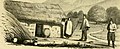
Camping on the muddy banks exposed the crew to malaria and aggressive wildlife.
Because the rivers were too dangerous to navigate at night, the expedition had to make camp on the muddy banks every evening. These camps were miserable affairs. The men slept in hammocks slung between trees or on the damp ground, constantly battling vampire bats, venomous snakes, and the suffocating heat.
Gibbon noted that the indigenous paddlers were far better adapted to these conditions, effortlessly constructing waterproof shelters from palm fronds in minutes, while the Americans struggled with their heavy canvas tents.
 14. The Flooded Forests

The expedition rarely left their boats; venturing into the flooded forest on foot meant certain death by getting hopelessly lost.
During the rainy season, the Amazon and its tributaries flood their banks, expanding for miles into the forest. Gibbon documented the surreal experience of paddling their canoes directly through the treetops of the submerged jungle.
This environment, while beautiful, was terrifying to navigate. There were no riverbanks to camp on, and the risk of the canoe becoming hopelessly entangled in the submerged vines or punctured by a hidden branch was constant.
 15. Reaching the Main Amazon

Gibbon finally reached the main trunk of the Amazon after surviving the brutal Madeira tributaries.
After months of harrowing travel, Gibbon finally cleared the rapids of the Madeira and merged into the main trunk of the Amazon River, entering Brazilian territory. The sheer scale of the water here was staggering compared to the narrow, rocky streams he had left behind in the Andes.
The lower Amazon was already seeing the beginnings of international trade, with small Brazilian settlements trading dried fish, turtle oil, and wild rubber downriver toward the Atlantic port of Pará.
Part IV: The Final Stretch and Legacy (Chapters 16-25)
 16. The Brazilian Forts

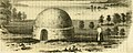
The Brazilian Empire maintained small, heavily armed forts along the river to control trade and deter European rivals.
As Herndon and Gibbon sailed deeper into Brazil, they encountered isolated military outposts. The Brazilian Empire was highly suspicious of foreign explorers, particularly Americans, fearing they intended to annex the Amazon under the doctrine of “Manifest Destiny.”
Herndon had to use intense diplomatic tact to navigate these checkpoints, assuring local commanders that his mission was purely scientific and navigational, despite his secret orders to evaluate the region for American economic expansion.
 17. Manaus: The Jungle Metropolis

As they reached the confluence of the Rio Negro, settlements became larger and more robust.
Herndon eventually reached the settlement of Barra do Rio Negro (modern-day Manaus). At the time, it was a wretched, poverty-stricken outpost.
However, Herndon accurately predicted its future. He noted its strategic location at the junction of the Amazon and Rio Negro. Decades later, during the Rubber Boom, Manaus would explode into one of the wealthiest cities in the world, complete with a grand European opera house funded entirely by the brutal exploitation of the jungle’s rubber.
 18. The Dream of Steam Power

Herndon’s entire mission was to prove the river was deep enough for large, ocean-going steamships.
Herndon’s final report to the US Congress was essentially a massive advertisement for the commercial development of the Amazon. He argued passionately that the introduction of American steamships would conquer the river’s current, opening up a continent of untapped resources to global trade.
His report successfully pressured the Brazilian government to finally open the Amazon River to international shipping in 1867, forever altering the ecology and demographics of the basin.
 19. Arriving at the Atlantic

The river becomes so wide near the Atlantic that it resembles a muddy ocean.
After nearly a year of grueling travel, disease, and starvation, Herndon arrived at the Atlantic port city of Pará (modern-day Belém) in April 1852. Gibbon arrived several months later after completing his longer, more dangerous southern route.
They had successfully crossed the continent, mapping thousands of miles of previously undocumented waterways and proving that the Amazon was indeed navigable from the foothills of the Andes to the ocean.
 20. The Publication of the Report

The lithographs produced from their sketches gave the American public their first true look at the Amazon.
Upon returning to Washington D.C., Herndon published Exploration of the Valley of the Amazon in 1853 (with Gibbon’s volume following in 1854). The book was a massive bestseller, filled with thrilling tales of survival and detailed maps.
It captured the imagination of the American public and politicians alike, directly influencing US foreign policy toward South America and setting the stage for decades of commercial exploitation of the rainforest.
 21. The Tragic Legacy of Herndon

Herndon survived the Amazon, but ironically died at sea shortly after.
Despite surviving one of the most grueling land expeditions in history, William Lewis Herndon met a tragic end shortly after his book was published. In 1857, he was the captain of the commercial mail steamer SS Central America.
The ship was caught in a massive hurricane off the coast of the Carolinas. After ensuring the safe evacuation of the women and children, Herndon chose to go down with his ship. He was hailed as a national hero, and a monument stands in his honor at the US Naval Academy.
 22. Setting the Stage for Biology

Herndon’s maps provided the foundation for later scientists to enter the deep jungle.
Herndon and Gibbon were geographers, not trained biologists. While they noted the animals and plants they saw, they did not collect scientific specimens. However, their maps and navigational charts were the key that unlocked the Amazon for future naturalists.
Without their painstaking hydrographic work proving that the deep interior was accessible by boat, legendary naturalists like Alfred Russel Wallace and Henry Walter Bates would have found it significantly harder to mount their famous biological expeditions a decade later.
 23. The 1921 Mulford Expedition

A label used to tag the thousands of specimens collected during the 1921 pharmaceutical expedition.
Decades after Herndon’s journey, the nature of Amazon exploration changed from purely geographic to intensely biological. A prime example is the Mulford Biological Exploration of the Amazon Basin (1921-1922).
Funded by a pharmaceutical company, this expedition was tasked with finding new medicinal plants and charting the deep biology of the Bolivian Amazon. They followed the exact difficult southern routes that Lardner Gibbon had mapped 70 years earlier.
 24. From Exploration to Exploitation

Opening the river to steamships brought wealth to a few, and destruction to the forest and its native people.
The legacy of these early 19th-century explorations is heavily mixed. While they are celebrated as massive feats of endurance and vital contributions to human geographic knowledge, they were the catalyst for catastrophe.
By mapping the rivers and proving the wealth of the jungle, men like Herndon unwittingly paved the way for the devastating Rubber Boom, which resulted in the enslavement and genocide of hundreds of thousands of indigenous Amazonians.
 25. Summary FAQ: The Golden Age of Exploration

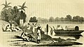
By the late 19th century, the main trunks of the Amazon were fully mapped, ending the era of blind exploration.
Why was the 1851 Herndon/Gibbon expedition important?
It provided the first accurate, scientifically backed hydrographic maps of the Amazon River, proving it was navigable by large steamships from the Andes to the Atlantic Ocean.
How did they document their journey without cameras?
They relied entirely on detailed, hand-drawn sketches. Upon returning to the US, these sketches were turned into highly detailed lithographs to be published in their official government reports.
What was the negative consequence of their exploration?
Their glowing reports of untapped natural wealth, particularly wild rubber, directly stimulated foreign investment that led to the brutal, exploitative Amazon Rubber Boom that devastated indigenous populations.
Explore our trusted network of partner websites covering directories, encyclopedias, marketplaces, education, and finance.
- This digital encyclopedia is created solely as an educational reference material detailing the historical exploration of the Amazon Basin.
- All included image multimedia content is distributed from the free open-license directory (Public Domain/Creative Commons) belonging to the worldwide Wikimedia Commons database.
- Historical facts are based on the published 1853 and 1854 expedition journals of Lieutenants Herndon and Gibbon.
About the Drafting Team: Atechsur.org Historical Geography Experts
The editorial board of Atechsur.org proactively provides accurate, in-depth historical reports with a dedication to engaging, humanistic language to foster a deeper understanding of geographical exploration and its consequences.
© 2026 – Atechsur.org – Complete Amazon Exploration History (Chapters 1 – 25)
19th Century Expeditions • Public Domain Archives • Updated: April 1, 2026